Route, GPS, Maps, Elevation Profile
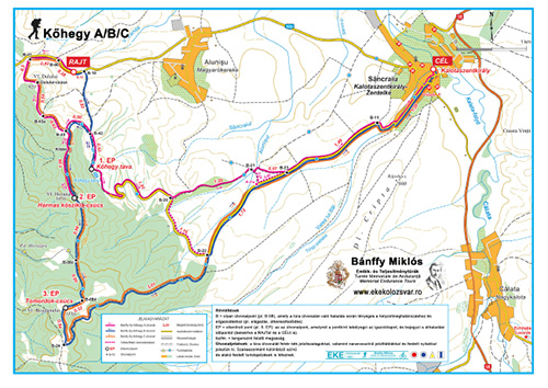
The route of the Hiking Kőhegy A tour:
Kalotaszentkirály-Zentelke (Sâncraiu), wedding hall (START) – Hármas kőszikla-csúcs (Horaița Peak) (CP 2) – Kőhegy tava (Horaiței Lake) (CP1) – Kalotaszentkirály-Zentelke (Sâncraiu), wedding hall (FINISH).
Difficulty: low.
The route of the Hiking Kőhegy B tour:
Kalotaszentkirály-Zentelke (Sâncraiu), wedding hall (START) – Kőhegy tava (Horaiței Lake) (CP1) – Hármas kőszikla-csúcs (Horaița Peak) (CP 2) – Tomordok-csúcs (Bogdanului Peak) (CP 3) – Kalotaszentkirály-Zentelke (Sâncraiu), wedding hall (FINISH).
Difficulty: low.
The route of the Hiking Kőhegy C tour:
Kalotaszentkirály-Zentelke (Sâncraiu), wedding hall (START) – Hármas kőszikla-csúcs (Horaița Peak) (CP 2) – Tomordok-csúcs (Bogdanului Peak) (CP 3) – Kalotaszentkirály-Zentelke (Sâncraiu), wedding hall (FINISH).
Difficulty: low.
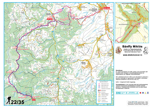
The route of the Hiking 22 tour:
Stanciu Glade (START) – Răchițele (Bridal Veil) Waterfall (CP 1) – Fehér-kövek (Pietrele Albe) (CP 2) – Vlădeasa Hut (CP 3) – Havasrogoz (Rogojel), Sequoia (CP 4) – Székelyjó (Săcuieu) (FINISH).
Difficulty: medium.
The route of the Hiking 35A tour:
Stanciu Glade (START) – Răchițele (Bridal Veil) Waterfall (CP 1) – Fehér-kövek (Pietrele Albe) (CP 2) – Vlădeasa Hut (CP 3) – Havasrogoz (Rogojel), Sequoia (CP 4) – Székelyjó (Săcuieu) (CP 5) – Kőhegy tava (Horaiței Lake) (CP 6) – Kalotaszentkirály-Zentelke (Sâncraiu) (FINISH).
Difficulty: medium.
The route of the Hiking 35B tour:
Stanciu Glade (START) – Răchițele (Bridal Veil) Waterfall (CP 1) – Fehér-kövek (Pietrele Albe) (CP 2) – Vlădeasa Hut (CP 3) – Havasrogoz (Rogojel), Sequoia (CP 4) – Székelyjó (Săcuieu) (CP 5) – Hármas kőszikla (Horaița Peak) (CP 6) – Kőhegy tava (Horaiței Lake) (CP 7) – Kalotaszentkirály-Zentelke (Sâncraiu), wedding hall (FINISH).
Difficulty: medium.
The time limit set by the organizers is 8 hours (Hiking 22) and 11 hours (Hiking 35A/B) respectively; all participants must arrive to Székelyjó (Săcuieu) by 17:00 and to Kalotaszentkirály-Zentelke (Sâncraiu) by 20:00. The time limit of the Hiking Kőhegy A/B/C tour is 5–6.5 hours, depending on the chosen version.
| Bánffy Gy22 | Bánffy Gy35A | Bánffy Gy35B | Gy Kőhegy A | Gy Kőhegy B | Gy Kőhegy C | |
|---|---|---|---|---|---|---|
| Distance | 22.29 km | 34.31 km | 35.21 km | 11.93 km | 13.62 km | 13.19 km |
| Total ascent | 1125 m | 1437 m | 1656 m | 440 m | 574 m | 583 m |
| Total descent | 1420 m | 1773 m | 1992 m | 614 m | 752 m | 758 m |
The route is presented in detail with printed and digital maps, as well as GPS track. The route will be marked partially with sign-boards and ribbons. Important! Due to several unpleasant experiences in previous years and because most of the trail markers were removed before the day of the hike, we have decided not to mark the following route anymore: Stanciu Glade – Răchițele (Bridal Veil) Waterfall – Fehér-kövek (Pietrele Albe) – Vlădeasa Hut. Therefore, we kindly ask those who are not familiar with the route to download the map or the digital track and use it if necessary.
For participants who for some reason cannot or do not want to continue the tour, we recommend the following places (easily accessible by car) to drop out: Székelyjó (Săcuieu), Kőhegy tava (Horaiței Lake).
In exceptional cases (e.g. extreme weather conditions) the organizers reserve the right to change the tour course or to cancel the whole tour or certain stages of it.
Map, route description / Elevation profile
The map, route description and elevation profile of the tour can be downloaded from here:
Hiking 22/35
Hiking Kőhegy A/B/C
Tour track
Hiking Kőhegy A – the track can be downloaded in gpx format from here
Hiking Kőhegy B – the track can be downloaded in gpx format from here
Hiking Kőhegy C – the track can be downloaded in gpx format from here
Hiking 22 – the track can be downloaded in gpx format from here
Hiking 35A – the track can be downloaded in gpx format from here
Hiking 35B – the track can be downloaded in gpx format from here
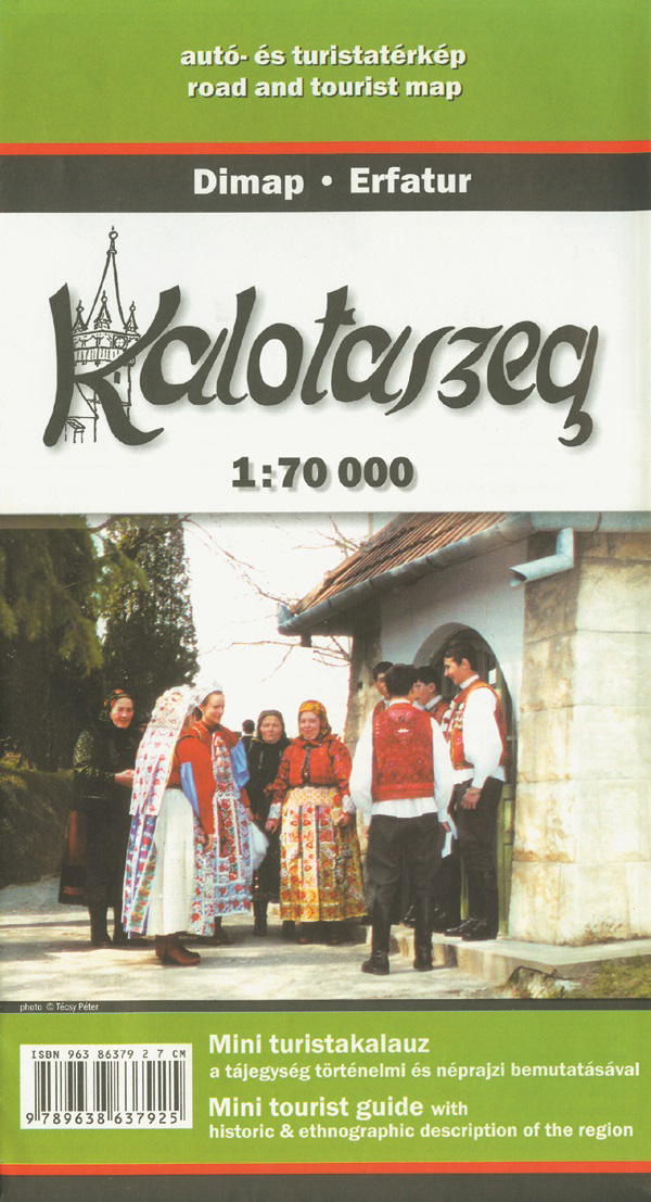
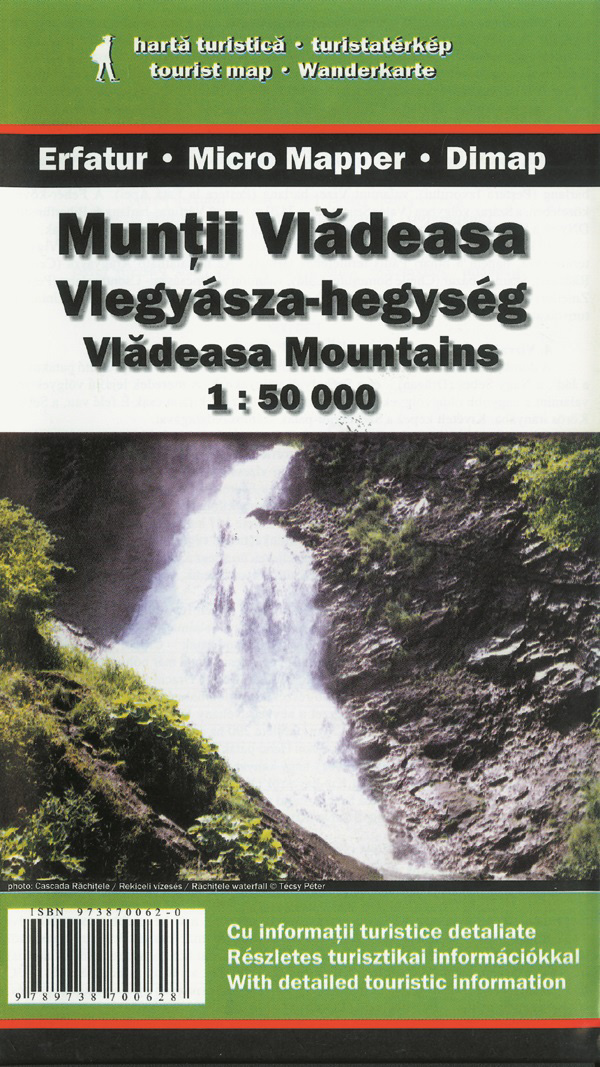
Other recommended maps
Beside the maps and directions provided by the organizers, we recommend the following printed maps, containing detailed information on certain sections of the Bánffy endurance tour.