Route, GPS, Maps, Elevation Profile
Attention! The digital routes and maps may be subject to minor changes. The final versions will be available a few days before the event.
K53 bicycle tour
Route: Cluj (Kolozsvár), Rooster Church (START) – Hoia forest – Hoia hill (Kányafő, CP 1) – Suceagului hill (Kis-Martonos tető) – Bátori hill (Bátori-hegy, CP 2) – Kapulat saddle – A3 motorway – Gârbău road (CP 3) – Bear hill (Medvepad) – Gyerőfi rock – Dumbrava (Gyerővásárhely), Reformed Church parsonage (CP 4) – Leghia (Jegenye) road (CP 5) – Ordományos hill – Riseg hill (CP 6) – Stana (Sztána), Szentimrei Villa (FINISH).
The length of the course is 53,40 km, the target time set by the organizers for the completion of the tour is 10 hours
Total ascent: 1571 m, total descent: 1382 m.
Difficulty: high.
K62 bicycle tour (extended version of K53)
Route: Cluj (Kolozsvár), Rooster Church (START) – Hoia forest – Hoia hill (Kányafő, CP 1) – Suceagului hill (Kis-Martonos tető) – Bátori hill (Bátori-hegy, CP 2) – Kapulat saddle – A3 motorway – Gârbău road (CP 3) – Bear hill (Medvepad) – Gyerőfi rock – Dumbrava (Gyerővásárhely), Reformed Church parsonage (CP 4) – Leghia (Jegenye) road (CP 5) – Ordományos hill – Riseg hill (CP 6) – Jebucu (Zsobok), Reformed Church (CP 7) – Stana (Sztána), Reformed Church (CP 8) – Stana (Sztána), Szentimrei Villa (FINISH).
The length of the course is 61,63 km, the target time set by the organizers for the completion of the tour is 11 hours
Total ascent: 1740 m, total descent: 1552 m.
Difficulty: high.
K28 bicycle tour
Route: Gârbău road (START) – Bear hill (Medvepad) – Gyerőfi rock – Dumbrava (Gyerővásárhely), Reformed Church parsonage (CP 4) – Leghia (Jegenye) road (CP 5) – Ordományos hill – Riseg hill (CP 6) – Stana (Sztána), Szentimrei Villa (FINISH).
The length of the course is 27,44 km, the target time set by the organizers for the completion of the tour is 5 hours
Total ascent: 805 m, total descent: 883 m.
Difficulty: medium.
Note: At request, the organizers provide transportation for participants and their bicycles to: DN1, E60 European Road (Bendkopp driveway).
K36 bicycle tour (extended version of K28)
Route: Gârbău road (START) – Bear hill (Medvepad) – Gyerőfi rock – Dumbrava (Gyerővásárhely), Reformed Church parsonage (CP 4) – Leghia (Jegenye) road (CP 5) – Ordományos hill – Riseg hill (CP 6) – Jebucu (Zsobok), Reformed Church (CP 7) – Stana (Sztána), Reformed Church (CP 8) – Stana (Sztána), Szentimrei Villa (FINISH).
The length of the course is 35,67 km, the target time set by the organizers for the completion of the tour is 6 hours
Total ascent: 974 m, total descent: 1053 m.
Difficulty: medium.
Note: At request, the organizers provide transportation for participants and their bicycles to: DN1, E60 European Road (Bendkopp driveway).
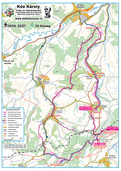
K33-Alszeg bicycle tour
Route: Stana (Sztána), Reformed Church (START) – Petrinzel (Kispetri), Reformed Church (CP 2) – Almaş fortress (CP 3) – Sfăraș (Farnas), Reformed Church (CP 3a) – Jebucu (Zsobok), Reformed Church (CP 4) – Riseg hill (CP 5) – Stana (Sztána), Szentimrei Villa (FINISH)
The length of the course is 33,34 km, the target time set by the organizers for the completion of the tour is 6 hours
Total ascent: 673 m, total descent: 593 m.
Difficulty: medium.
Note: At request, the organizers provide transportation for participants and their bicycles to: Stana (Sztána), Reformed Church.
K16 bicycle tour
Route: Dumbrava (Gyerővásárhely), Reformed Church parsonage (START) – Leghia (Jegenye) road (CP 5) – Ordományos hill – Riseg hill (CP 6) – Stana (Sztána), Szentimrei Villa (FINISH).
The length of the course is 16,07 km, the target time set by the organizers for the completion of the tour is 5 hours
Total ascent: 481 m, total descent: 583 m.
Difficulty: low.
Note: At request, the organizers provide transportation for participants and their bicycles to: Dumbrava (Gyerővásárhely), Reformed Church parsonage.
K25 bicycle tour (extended version of K16)
Route: Dumbrava (Gyerővásárhely), Reformed Church parsonage (START) – Leghia (Jegenye) road (CP 5) – Ordományos hill – Riseg hill (CP 6) – Jebucu (Zsobok), Reformed Church (CP 7) – Stana (Sztána), Reformed Church (CP 8) – Stana (Sztána), Szentimrei Villa (FINISH).
The length of the course is 24,30 km, the target time set by the organizers for the completion of the tour is 6 hours
Total ascent: 650 m, total descent: 753 m.
Difficulty: medium.
The route is presented in detail with descriptions, printed and digital maps, as well as GPS track. We will renew the painted tourist markings and will place sign-boards and ribbons to mark certain sections of the routes. Special sign-boards will be placed at every road junction with several route options.
If for some reason you cannot or do not want to continue the tour, we recommend the following places (accessible by car) to drop out:
K53/62, K28/36, K16/25: Kapulat saddle, Gârbău road (CP 3), Straja (Gesztrágy) (K-43), Dumbrava (Gyerővásárhely) (CP 4), Leghia (Jegenye) road (DJ 108C), Nadășu (Kalotanádas) road (135), Riseg hill (from here you can quickly descend to Izvoru Crișului (Körösfő)), Jebucu (Zsobok), Stana (Sztána).
K33-Alszeg: Petrinzel (Kispetri), Almașu (Váralmás), Sfăraș (Farnas), Jebucu (Zsobok)
In exceptional cases (e.g. extreme weather conditions) the organizers reserve the right to change the tour course or to cancel the whole tour or certain stages of it.
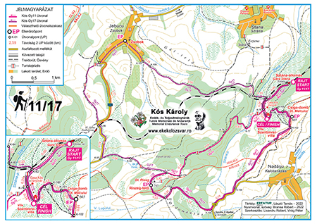
Tour maps (in Hungarian or Romanian) / Elevation profiles
Gy11/17
Gy19/24, K33-Alszeg
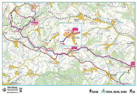
Gy52/58, K16/25, K28/36, K53/62
GPS tracks
Bicycle 62 – the track can be downloaded in gpx format from here
Bicycle 53 – the track can be downloaded in gpx format from here
Bicycle 36 – the track can be downloaded in gpx format from here
Bicycle 28 – the track can be downloaded in gpx format from here
Bicycle 33-Alszeg – the track can be downloaded in gpx format from here
Bicycle 25 – the track can be downloaded in gpx format from here
Bicycle 16 – the track can be downloaded in gpx format from here
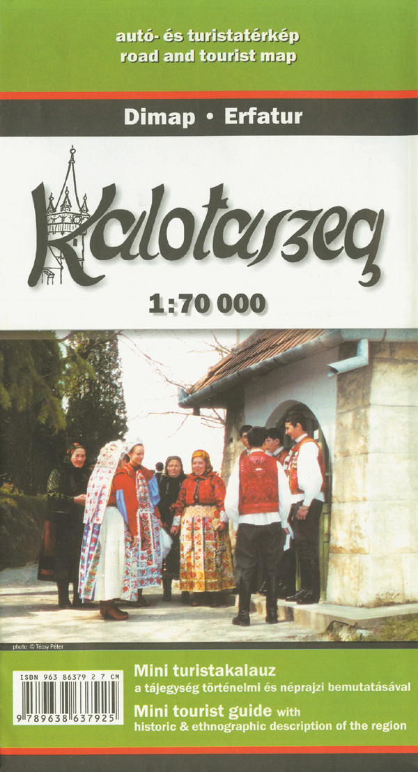
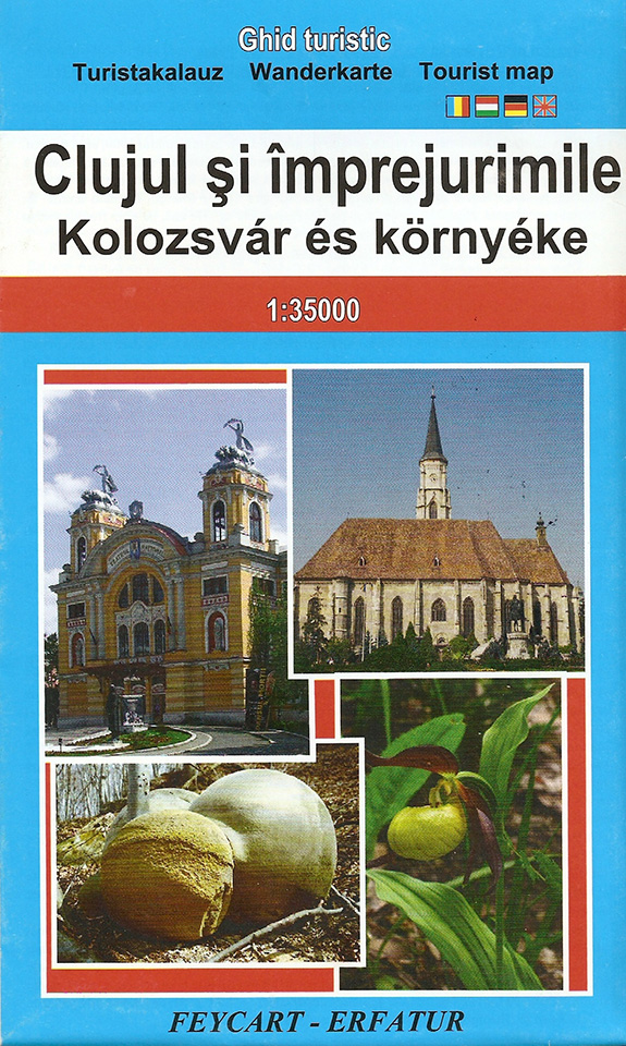
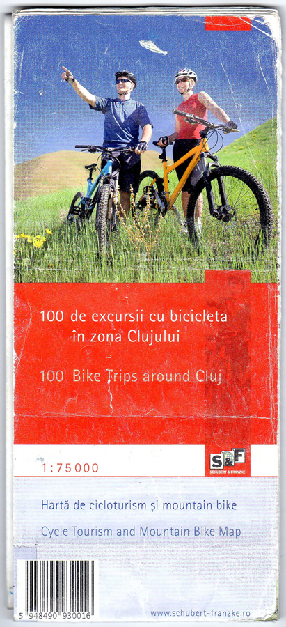
Other recommended maps
Beside the maps and directions provided by the organizers, we recommend the following printed maps, containing detailed information on certain sections of the Kós endurance tour.