Route, GPS, Maps, Elevation Profile
Attention! The digital routes and maps may be subject to minor changes. The final versions will be available a few days before the event.
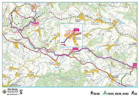
Gy52 hiking tour
Route: Cluj (Kolozsvár), Rooster Church (START) – Hoia forest – Hoia hill (Kányafő, CP 1) – Snail hill (Csiga-domb) in Florești (Szászfenes) – Suceagului hill (Kis-Martonos tető) – Bátori hill (Bátori-hegy, CP 2) – Kapulat saddle – A3 motorway – Gârbău road (CP 3) – Bear hill (Medvepad) – Gyerőfi rock – Dumbrava (Gyerővásárhely), Reformed Church parsonage (CP 4) – Leghia (Jegenye), quarry byroad (CP 5) – Ordományos hill – Riseg hill (CP 6) – Stana (Sztána), Szentimrei Villa (FINISH).
The length of the race is 51,99 km, the target time set by the organizers for its completion is 12 hours
Total ascent: 1536 m, total descent: 1346 m.
Difficulty: high.
Gy58 hiking tour (extended version of Gy53)
Route: Cluj (Kolozsvár), Rooster Church (START) – Hoia forest – Hoia hill (Kányafő, CP 1) – Snail hill (Csiga-domb) in Florești (Szászfenes) – Suceagului hill (Kis-Martonos tető) – Bátori hill (Bátori-hegy, CP 2) – Kapulat saddle – A3 motorway – Gârbău road (CP 3) – Bear hill (Medvepad) – Gyerőfi rock – Dumbrava (Gyerővásárhely), Reformed Church parsonage (CP 4) – Leghia (Jegenye), quarry byroad (CP 5) – Ordományos hill – Riseg hill (CP 6) – Jebucu (Zsobok), Reformed Church (CP 7) – Stana (Sztána), Szentimrei Villa (FINISH).
The length of the race is 57,76 km, the target time set by the organizers for its completion is 13 hours
Total ascent: 1704 m, total descent: 1515 m.
Difficulty: high.
Gy24 hiking tour
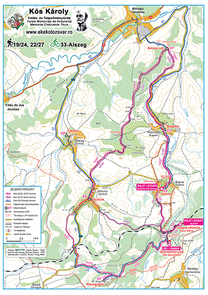
Route: Stana (Sztána), Reformed Church (START) – Petrinzel (Kispetri), Reformed Church (CP 1) – Almaş fortress (CP 2) – Jebucu (Zsobok), Reformed Church (CP 3) – Riseg hill (CP 4) – Stana (Sztána), Szentimrei Villa (FINISH)
The length of the race is 23,75 km, the target time set by the organizers for its completion is 7 hours
Total ascent: 778 m, total descent: 699 m.
Difficulty: medium.
Gy19 hiking tour (shortened version of Gy24)
Route: Stana (Sztána), Reformed Church (START) – Petrinzel (Kispetri), Reformed Church (CP 1) – Almaş fortress (CP 2) – Jebucu (Zsobok), Reformed Church (CP 3) – Stana (Sztána), Szentimrei Villa (FINISH).
The length of the race is 18,94 km, the target time set by the organizers for its completion is 6 hours
Total ascent: 579 m, total descent: 501 m.
Difficulty: medium.
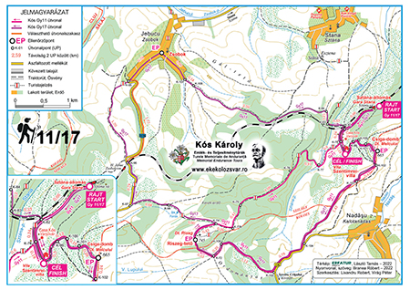
Gy11 hiking tour*
Route: Stana (Sztána), Reformed Church (START) – Snail hill (CP 1) – Riseg hill (CP 2) – Stana (Sztána), Szentimrei Villa (FINISH)
The length of the race is 12,3 km, the target time set by the organizers for its completion is 5 hours
Total ascent: 517 m, total descent: 440 m.
Difficulty: low.
Gy17 hiking tour* (extended version of Gy11)
Route: Stana (Sztána), Reformed Church (START) – Snail hill (CP 1) – Riseg hill (CP 2) – Jebucu (Zsobok), Reformed Church (CP 3) – Stana (Sztána), Szentimrei Villa (FINISH)
The length of the race is 18,2 km, the target time set by the organizers for its completion is 6 hours
Total ascent: 687 m, total descent: 609 m.
Difficulty: low.
Additional distance to cover after the tour: Szentimrei Villa – Stana (Sztána) village (2.67 km).
The route is presented in detail with descriptions, printed and digital maps, as well as GPS track. Certain sections of the route will be marked with sign-boards and ribbons.
For Gy52/58 participants who for some reason cannot or do not want to continue the tour, we recommend the following places (accessible by car) to drop out: Kapulat saddle, Gârbău road (CP 3), Straja (Gesztrágy) (K-43), Dumbrava (Gyerővásárhely) (CP 4), Leghia (Jegenye) road (DJ 108C), Nadășu (Kalotanádas) road (DC 135), Riseg hill (from here you can quickly descend to Izvoru Crișului (Körösfő)).
Participants of the Gy19/24 and Gy11/17 tours who for some reason cannot or do not want to continue the tour, notify the organizers or the checkpoint stewards (if needed, any checkpoint can be reached by car).
*The route of the Gy11 and Gy17 tours was partially modified last year; therefore, the starting point this year will also be in the village of Stana (Sztána), instead of at the train station. The routes are approximately 1.5 km longer than the usual 10.66 km and 16.43 km, respectively; however, we have kept the original names of the tours.
Route maps and elevation profiles
Gy11/17
Gy19/24, K33-Alszeg
Gy52/58, K16/25, K28/36, K53/62
Tour track
Hiking 58 – the track can be downloaded in gpx format from here
Hiking 52 – the track can be downloaded in gpx format from here
Hiking 24 – the track can be downloaded in gpx format from here
Hiking 19 – the track can be downloaded in gpx format from here
Hiking 17 – the track can be downloaded in gpx format from here
Hiking 11 – the track can be downloaded in gpx format from here
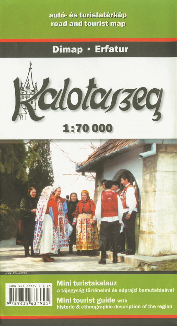
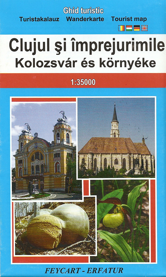
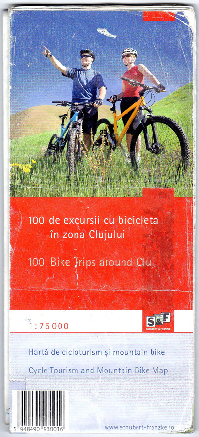
Other recommended maps
Beside the maps and directions provided by the organizers, we recommend the following printed maps, containing detailed information on certain sections of the Károly Kós endurance tour: