Route, GPS, Maps, Elevation Profile
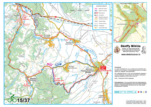
Route of the Bánffy K15 bicycle tour:
Kalotaszentkirály-Zentelke (Sâncraiu), wedding hall (START) – Kőhegy tava (Horaiței Lake, CP 1) – Magyarókereke (Alunișu) – Kalotaszentkirály-Zentelke (Sâncraiu), wedding hall (FINISH).
The route of the Bánffy K37 bicycle tour:
Kalotaszentkirály-Zentelke (Sâncraiu), wedding hall (START) – Kőhegy tava (Horaiței Lake, CP 1) – Székelyjó (Săcuieu) (CP 2) – Sebesvár (Bologa) (CP 3) – Marótlaka (Morlaca) – Malomszeg (Brăișoru) – Kalotaszentkirály-Zentelke (Sâncraiu), wedding hall (FINISH).
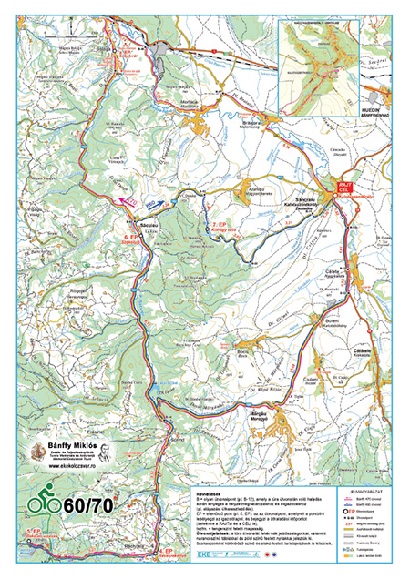
The route of the Bánffy K60/70 bicycle tour:
Kalotaszentkirály-Zentelke (Sâncraiu), wedding hall (START) – Nagykalota (Călata) – Meregyó (Mărgău) – Szkrind (Scrind-Frăsinet) – Havasrekettye (Răchițele) (CP 4) – Răchițele (Bridal Veil) Waterfall (CP 5) – Havasrekettye (Răchițele) – Székelyjó (Săcuieu) (CP 6)
Bánffy K60: Székelyjó (Săcuieu) (CP 6) – Kőhegy tava (Horaiței Lake) (CP 7) – Kalotaszentkirály-Zentelke (Sâncraiu), wedding hall (FINISH).
Bánffy K70: Székelyjó (Săcuieu) (CP 6) – Sebesvár (Bologa) (CP 7a) – Kalotaszentkirály-Zentelke (Sâncraiu), wedding hall (FINISH).
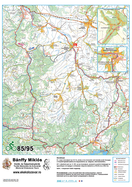
The route of the Bánffy K85/95 bicycle tour:
Kalotaszentkirály-Zentelke (Sâncraiu), wedding hall (START) – Magyarvalkó (Văleni) – Magyargyerőmonostor (Mănăstireni) (CP 1) – Jósikafalva (Beliș) (CP 2) – Kerekhegy (Dealu Botii) (CP 3) – Havasrekettye (Răchițele, CP 4) – Răchițele (Bridal Veil) Waterfall (CP 5) – Havasrekettye (Răchițele) – Székelyjó (Săcuieu, CP 6)
Bánffy K85: Székelyjó (Săcuieu) (CP 6) – Kőhegy tava (Horaiței Lake) (CP 7) – Kalotaszentkirály-Zentelke (Sâncraiu), wedding hall (FINISH).
Bánffy K95: Székelyjó (Săcuieu) (CP 6) – Sebesvár (Bologa) (CP 7a) – Kalotaszentkirály-Zentelke (Sâncraiu), wedding hall (FINISH).
The route runs on paved roads, with the following exceptions:
– at the end of the road leading to the Răchițele Waterfall, about 1 km of macadam road leading to the CP
– from the Székelyjó (Săcuieu) – Magyarókereke (Alunișu) road to Horaiței Lake, about 1.5 km of good quality, grassy dirt road.
The time limit set by the organizers is 5 hours (Bicycle 60/70) and 10 hours (Bicycle 85/95) respectively; all participants must arrive to Kalotaszentkirály-Zentelke (Sâncraiu) by 19:30. According to our estimations, the Bicycle 60/70 tour can be completed in 4-5 hours, the Bicycle 85/95 tour in 8-9 hours. The time limit for the K15 tour is 4 hours, while for the K37 tour it is 6 hours.
| Bánffy K60 | Bánffy K70 | Bánffy K85 | Bánffy K95 | Bánffy K37 | Bánffy K15 | |
|---|---|---|---|---|---|---|
| Distance | 58.47 km | 69.84 km | 83.40 km | 94.78 km | 37.47 km | 14.47 km |
| Total ascent | 974 m | 885 m | 1786 m | 1695 m | 605 m | 367 m |
| Total descent | 976 m | 884 m | 1787 m | 1694 m | 603 m | 364 m |
Tour difficulty:
– low (Bánffy K15, K37) – can be easily completed by anybody, recommended especially for families with children
– medium (Bánffy K60/70) – can be completed by anybody
– high (Bánffy K85/95) – recommended for experienced riders
Map, route description / Elevation profile
The map, route description and elevation profile of the tour can be downloaded from here:
Bicycle 15/37
Bicycle 60/70
Bicycle 85/95
Tour track
Bicycle 15 – the track can be downloaded in gpx format from here
Bicycle 37 – the track can be downloaded in gpx format from here
Bicycle 60 – the track can be downloaded in gpx format from here
Bicycle 70 – the track can be downloaded in gpx format from here
Bicycle 85 – the track can be downloaded in gpx format from here
Bicycle 95 – the track can be downloaded in gpx format from here
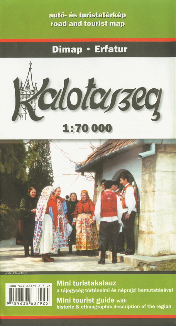
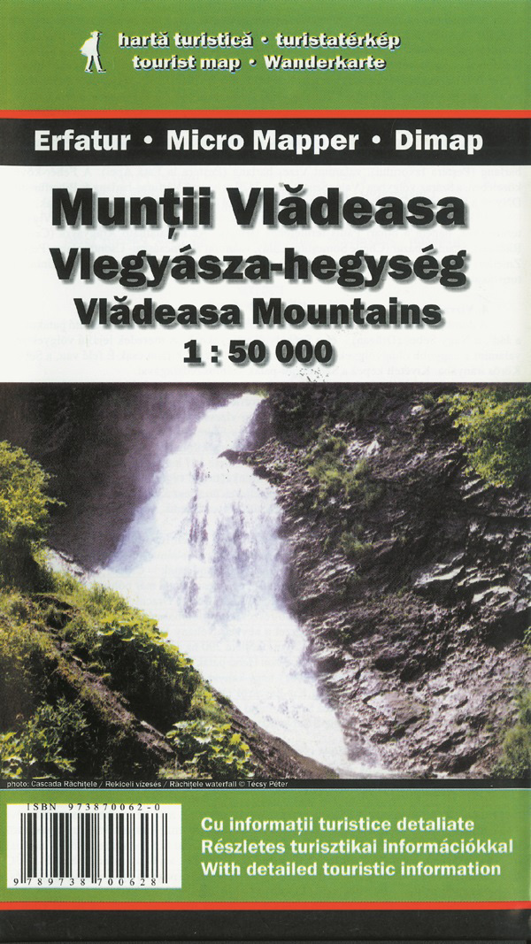
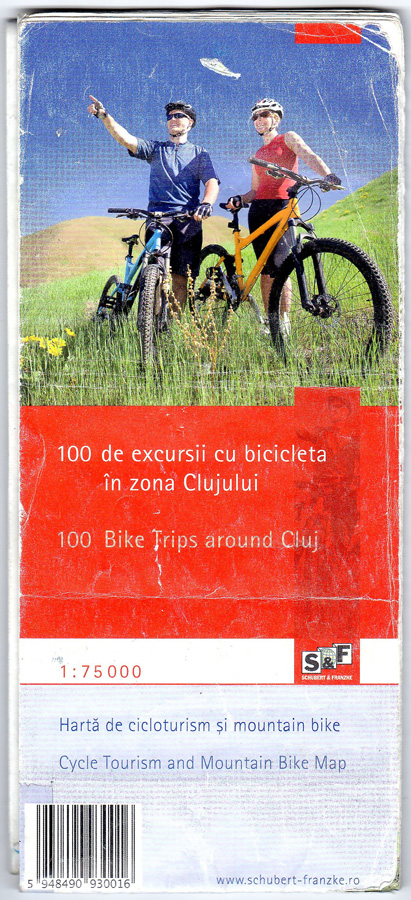
Other recommended maps
Beside the maps and directions provided by the organizers, we recommend the following printed maps, containing detailed information on certain sections of the Bánffy endurance tour.